When my wife and I were debating about whether we wanted to move to the PNW and deal with the high cost of living or move to North Carolina and not have majestic mountains it was really a no-brainer.
We couldn’t leave the mountains.
No matter where you are in Oregon (or the PNW) you can find some mountains to escape to. Even in the morass of strangeness that Portland has become, you can find some distant mountain on a clear day.
But what mountains are you seeing?
Knowing which mountains are visible from Portland can help you to orient yourself within the city (and make you sound really cool if anyone asks).
However, the mountains which are visible from Portland vary significantly day by day depending on how clear it is (and how much pot smoke is lingering in the air).
On the clearest of days, from the right viewpoint, you might be able to see five Cascade volcanoes:
Mount Jefferson – southeast, faint and distant
Mount Hood – due east
Mount St. Helens – north-northeast, recognizable by its flat top
Mount Adams – northeast, often to the left of Hood
Mount Rainier – far north, occasionally peeking over the horizon
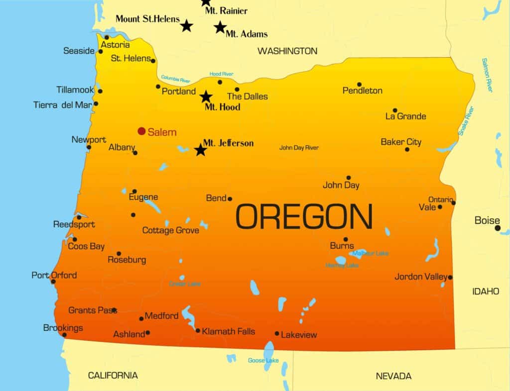
As you can see, some of these mountains are in Oregon, others are in Washington, but nearly all are volcanic and part of mountain ranges that can also be seen from within the city.
So let’s talk about how you can tell them apart and the places to go within Portland if you’re hoping for mountain views.
The Mountains Visible From Portland
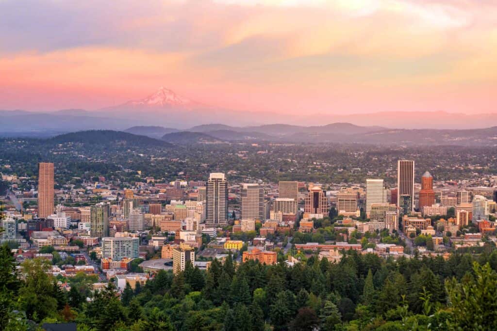
The Most Obvious One: Mount Hood
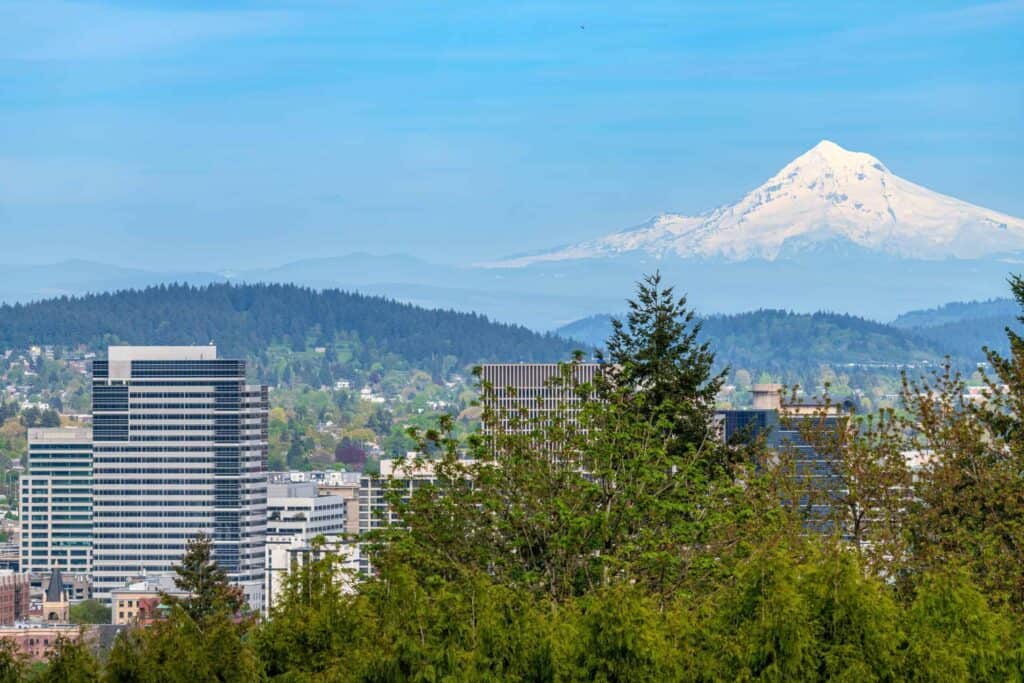
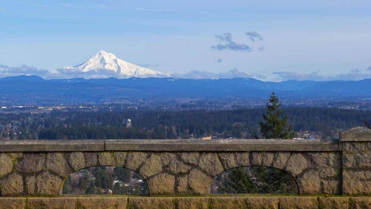
If you see one mountain from Portland, it’s probably Mount Hood.
This is Portland’s hometown volcano—tall, symmetrical, and snow-covered nearly year-round. It rises about 11,240 feet above sea level and is part of the Cascade Range. From Portland, it’s almost always visible to the east (when it’s not socked in by clouds), and it tends to catch the first and last light of the day in a way that makes it hard to ignore.
Mount Hood is about 50 miles from downtown as the crow flies, and while it looks peaceful from afar, it’s still considered an active stratovolcano. It hasn’t erupted in a long time, but geologists keep a close eye on it just in case.
Look North: Mount St. Helens
Mount St. Helens is instantly recognizable if you know what to look for: it’s the one with the top blown off.
After its catastrophic eruption in 1980, the mountain lost around 1,300 feet of elevation and took on a distinct crater-shaped appearance. It now stands at 8,366 feet and sits about 55 miles north-northeast of Portland.
On a clear day, you can see St. Helens from many parts of the city—especially if you’re north of downtown or have a view toward the Columbia River. From certain angles (like the Pittock Mansion or Rocky Butte), you can really appreciate its stark profile and how different it looks compared to the more classic cone shapes of other peaks.
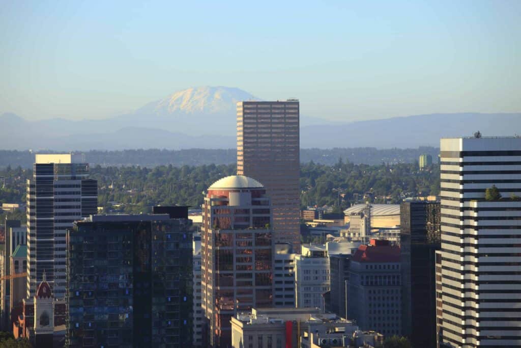
Slightly Farther North: Mount Rainier
Much farther in the distance—but still occasionally visible—is Mount Rainier.
At 14,411 feet, it’s the tallest mountain in the Cascade Range and one of the tallest in the contiguous United States. On especially clear days, Rainier can be seen rising above the horizon behind St. Helens, due north-northeast of Portland.
You’ll need just the right conditions to spot it—no haze, low humidity, and maybe a pair of binoculars—but when it’s visible, it’s breathtaking. The size and scale of it make even distant peaks look small.
Locals will tell you: if you can see Rainier from Portland, it’s going to be a beautiful day.
To the East-Northeast: Mount Adams
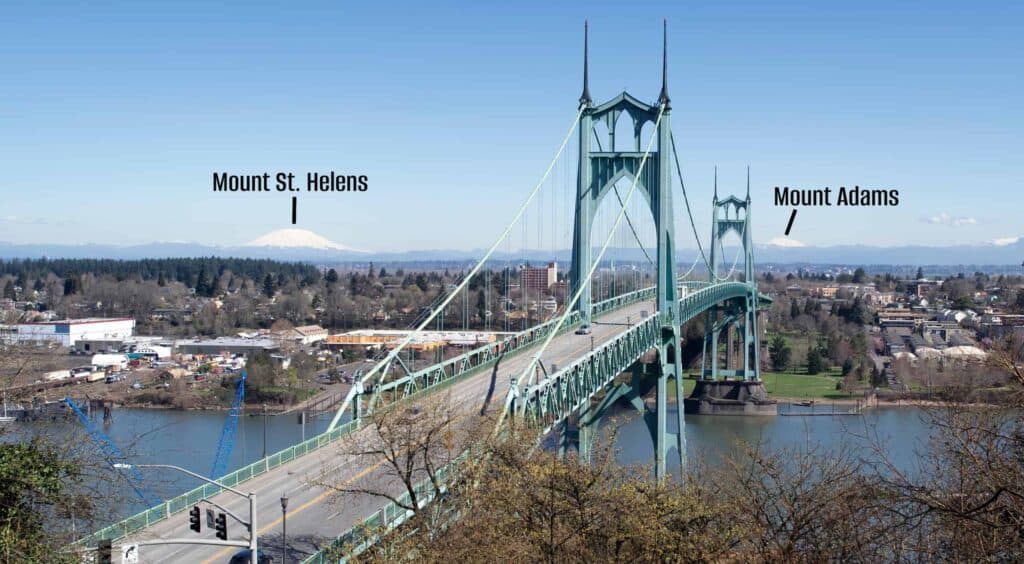
Mount Adams is a bit of a sneaky one. It doesn’t always stand out unless you’re actively looking for it.
It sits northeast of Mount Hood, across the Columbia River in Washington, and rises to 12,280 feet—making it the second-tallest mountain in the state of Washington. From Portland, you can sometimes spot it to the left of Mount Hood, especially from high vantage points like Powell Butte or the top floors of downtown buildings.
Adams is a classic cone-shaped stratovolcano, heavily glaciated and imposing when it’s fully visible. But it often blends into the background or gets lost in cloud layers unless conditions are perfect.
Rare Sightings: Mount Jefferson
Mount Jefferson is farther away—about 90 miles to the south-southeast of Portland—and because of that, it’s not always visible. But on especially clear days, it sometimes pops up on the southern horizon, particularly if you’re at a high elevation (say, Council Crest Park or a high floor in the West Hills).
It’s a rugged, pointed peak that reaches 10,495 feet, and while it’s harder to spot than Hood or St. Helens, it’s worth watching for. If you do catch a glimpse, you’ll understand why it’s one of Oregon’s most photographed peaks—even if it plays hard to get from Portland.
Best Places in Portland for Mountain Views
If you’re hunting for a perfect view (or just want a solid backdrop for a photo), here are a few of the best spots in town:
- Pittock Mansion – Arguably the best panoramic view of multiple peaks.
- Council Crest Park – Highest point in Portland, with great southern and eastern views.
- Rocky Butte – Lesser-known but with excellent northern sightlines.
- Portland Aerial Tram – A moving view, but one of the best ways to catch Hood and beyond.
- Top floors of the OHSU or South Waterfront buildings – Weather permitting, these often give you a peek at all the nearby giants.
Final Thoughts
Living in Portland means getting used to the fact that some days you wake up and it feels like the mountains are right outside your window. Other days… they disappear entirely. That’s just how it goes with Cascade volcanoes and PNW weather.
But when they’re out? It’s magic. Whether it’s your first visit or your hundredth commute across the Burnside Bridge, seeing Mount Hood rising in the distance never gets old.
So next time the skies clear, look up. Portland’s surrounded by giants—you just have to know where to look.
The 5 Best Historic Hotels In Washington State (My Opinion)

Is The Boeing Future Of Flight Tour Worth It? Our Experience
Top 5 Mysterious Natural Wonders In Washington & Oregon

The 5 Best Spa Resorts In Washington State (A Man’s Opinion)
5 Best Things To Do In Ocean Shores, WA (There Are Only 5…)
